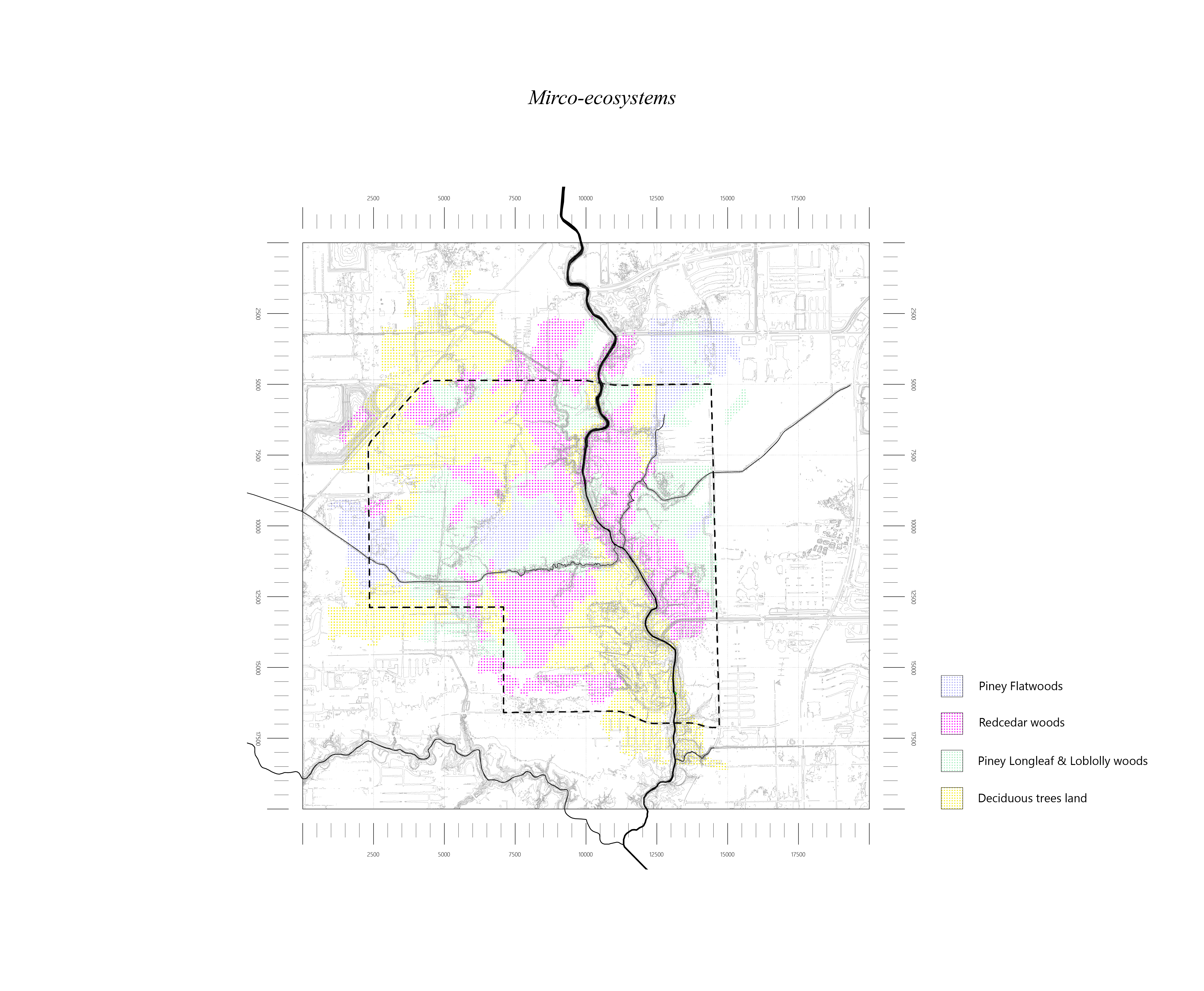
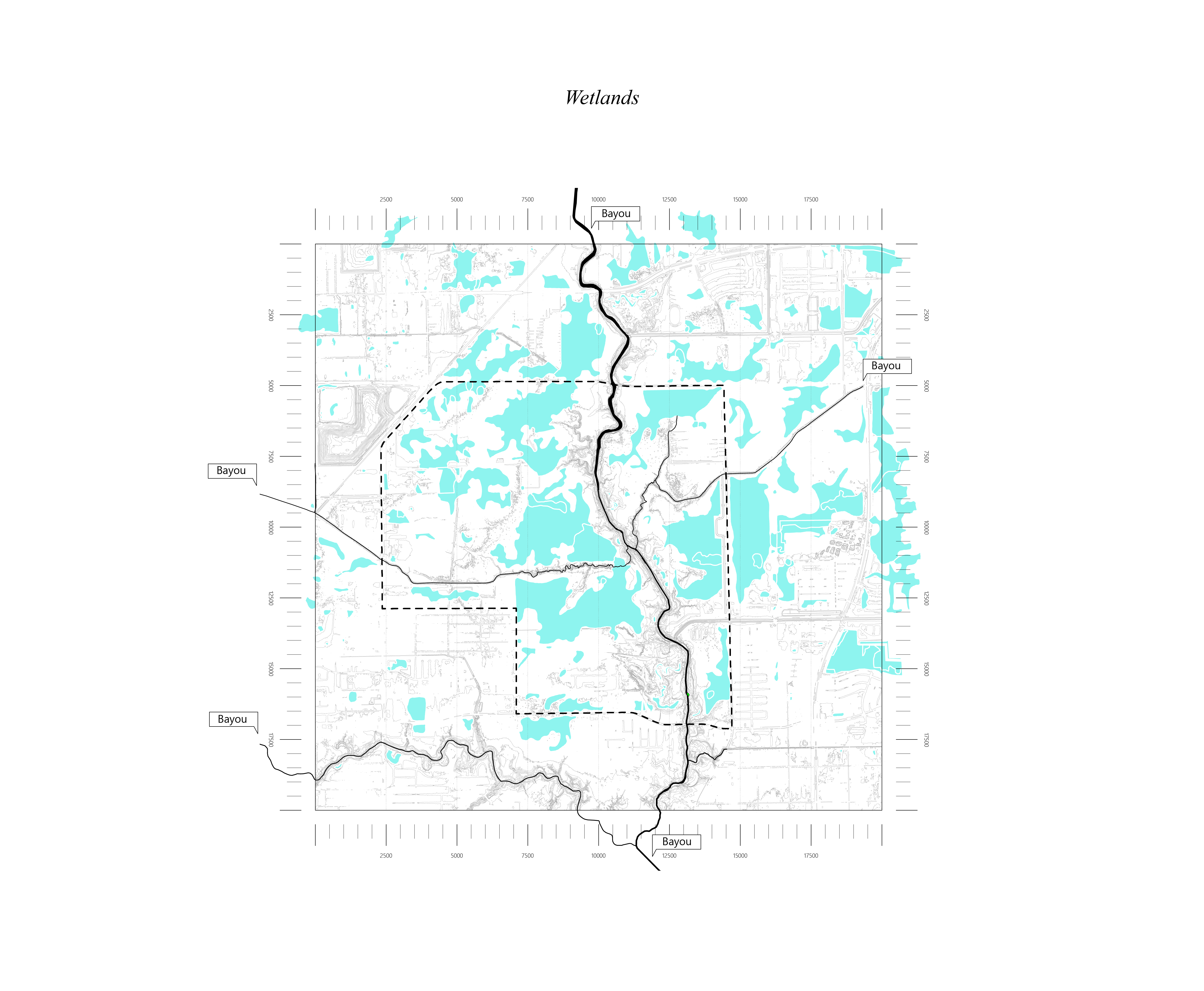
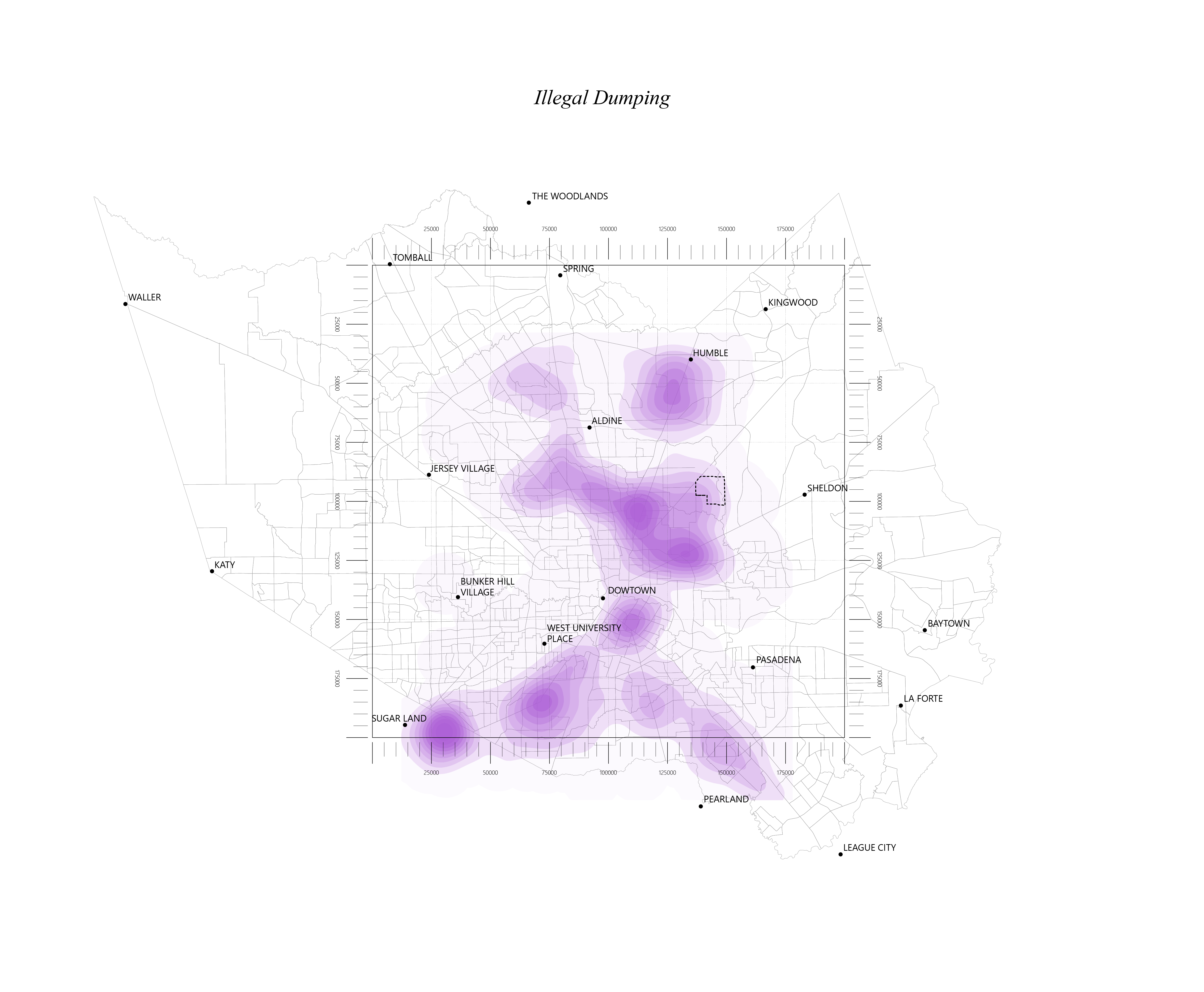
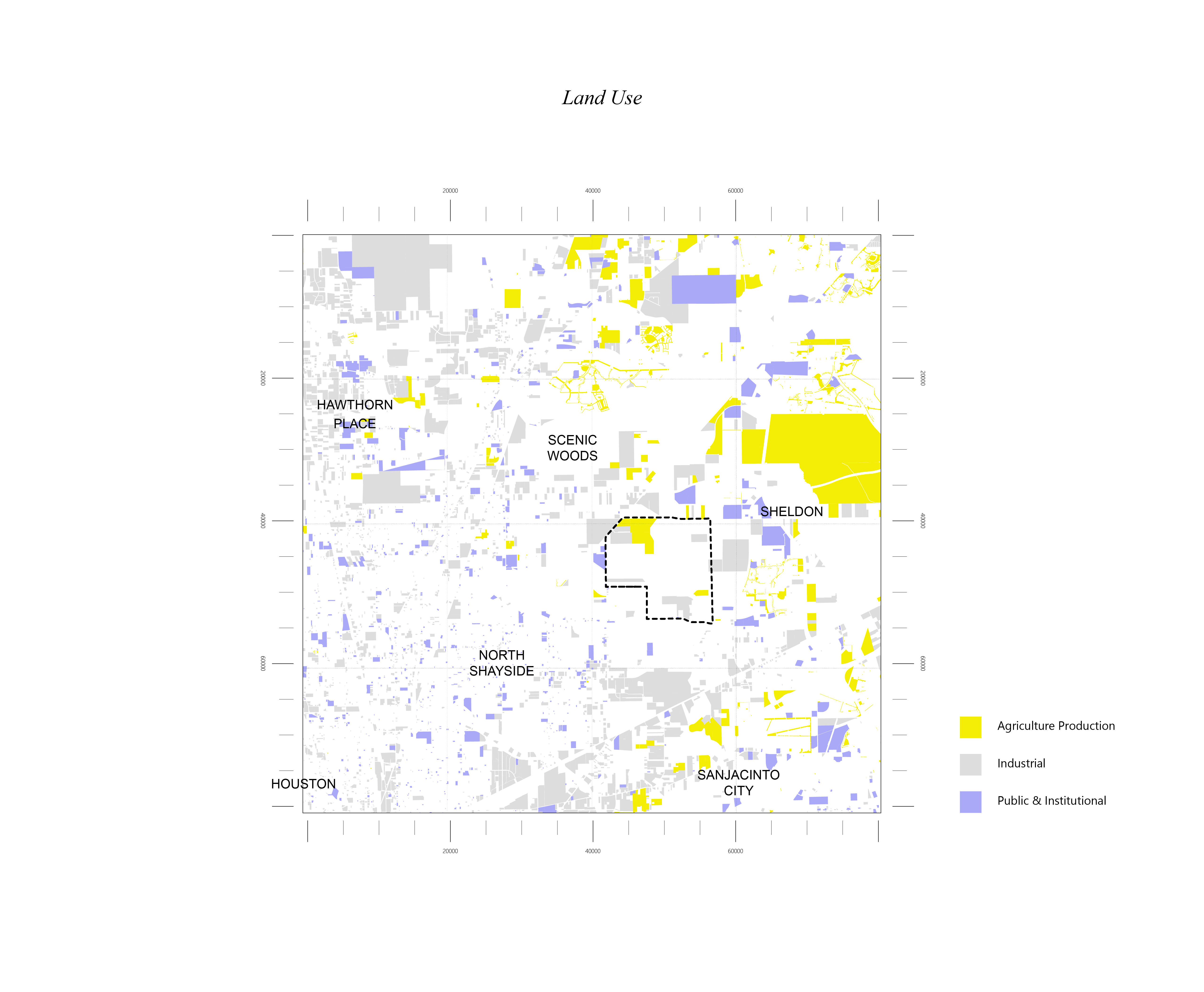
Raw data to story-telling
As part of the effort to deep map and study an unruly, forested site for analysis on potential building on land, raw datasets were gathered and plugged into ArcGIS to visualize data on site land and boundaries. Further design of data visualization were realized and enacted to compile a shared story of challenges and opportunities that site data was pointing to.
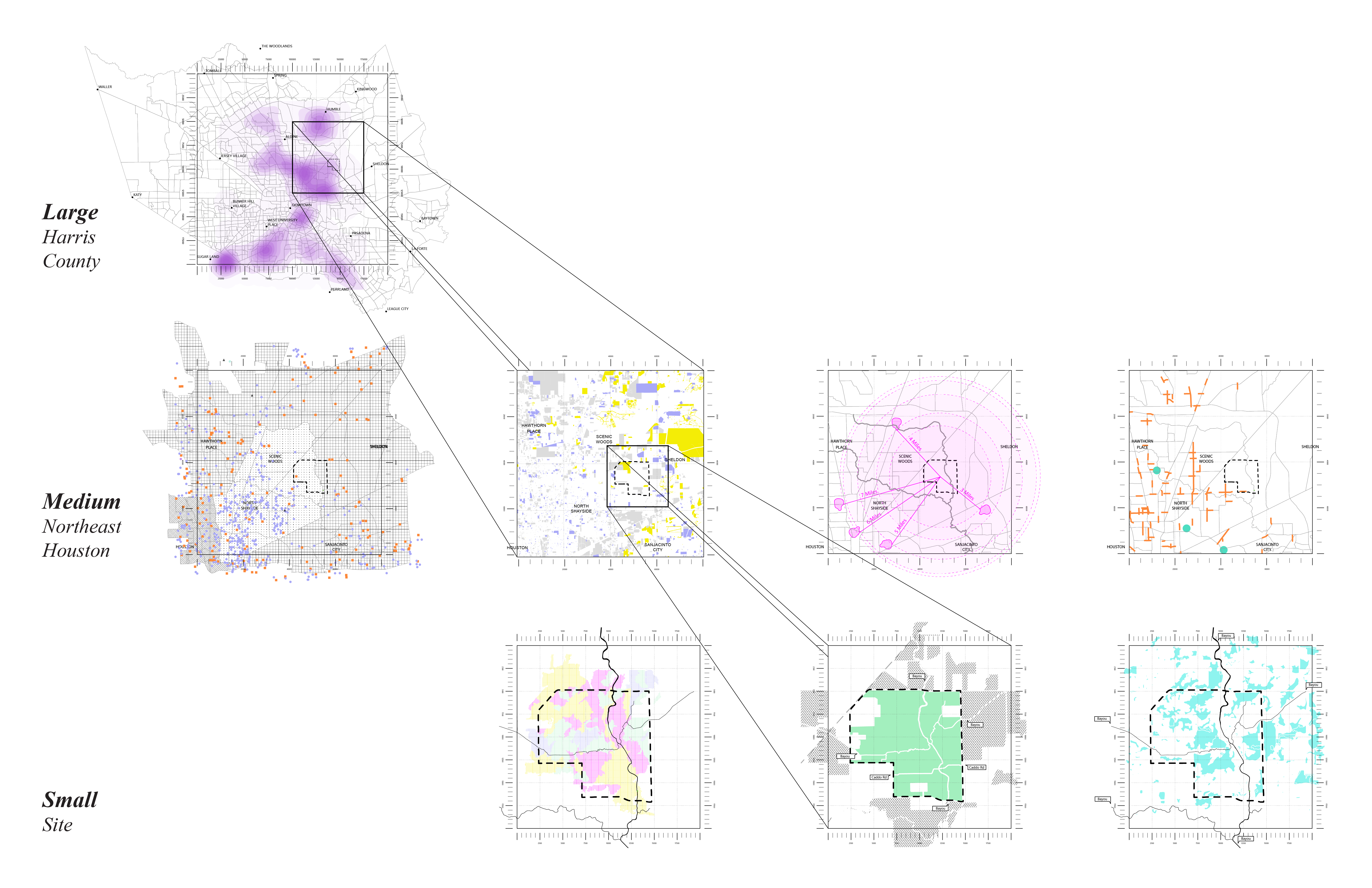
Problem at large-scale
Controlled definition at mid-scale


Finer identification at small-scale